Hyper Precise Location
NOTE: There are new documentation pages that contains updated dynamic code generation & SDK downloads. You can access the new documents here.
Emerging use cases in automated and autonomous vehicle and IoT services require high-precision positioning technologies that can significantly outperform basic GPS technology. There can be significant performance benefits from centimeter-level positioning accuracy for core applications such as autonomous driving, drone piloting, or industrial automation such as robotics.
Global Navigation Satellite System (GNSS) technologies such as Global Positioning System (GPS) are widely used today in almost all varieties of localization applications. However, traditional GNSS technologies only offer an accuracy level of three to nine meters. The inaccuracy is mainly caused by multiple error sources between the GNSS satellites and customer devices (e.g. satellite clock and orbit errors, as well as atmospheric errors).
Real Time Kinematics (RTK) is the core technology that provides hyper precise location data for IoT services where accuracy is critical. RTK drastically minimizes errors to provide hyper precise location accuracies of sub-meter or even centimeter-level in all three dimensions: horizontal (latitude & longitude) and vertical. Verizon has deployed reference stations across the US to provide pinpoint-level accuracy to RTK compatible IoT devices. Verizon Hyper Precise Location is carrier-grade, and built to scale with Verizon's reliability.
GNSS is Global Navigation Satellite System and can be used interchangeably with GPS (Global Positioning System).
RTK is Real Time Kinematics and DGNSS is Differential GNSS.
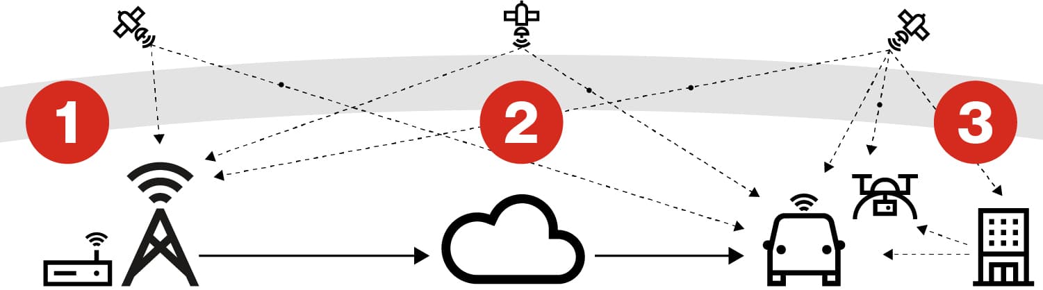
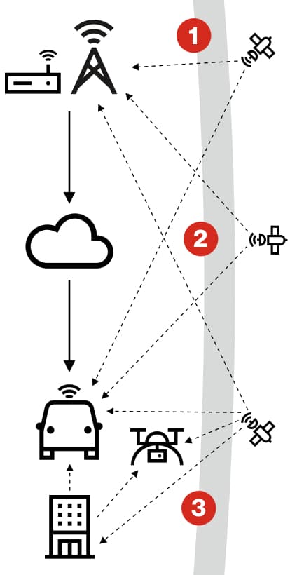
1. Verizon's RTK stations collect satellite data
The nation-wide RTK reference stations collect and send back GNSS Observables to a Verizon backend infrastructure for data processing.
2. Backend analyzes network-wide satellite data
The Verizon backend then distributes the GNSS correction data to the devices in the field.
3.Corrections minimize errors
The RTK-capable devices use the correction data to help determine their location with up to centimeter-level accuracy, in near real time.